Heading Photo: Cedid Atlas 1803 by Library of Congress used under Public Domain.
Geography
Throughout this page, you are welcome to explore the geography of North Africa. Travel through the winding rivers of the Niger and Nile, the Atlas Mountains and the Sahara Desert. Additionally, this website provides historical dates throughout the 1800s concerning exploration in North Africa and other interesting facts.
Rivers of North Africa
|
The Niger River
Located in Northern Africa, the Niger River runs some 2,600 miles, making it the third-longest river on the continent. The river originates in southeast Guinea, ending at the Gulf of Guinea, where it flows out into the Atlantic Ocean. (Gleick, 2000) By looking at the image to the right, it can be seen that the river has an interesting shape to it, looking almost like a boomerang. The Niger is joined by the Bani River, and at this point, it becomes a place containing backwaters, smaller streams, and lakes called the "internal delta." By the late 1700s leading into the mid 1800s, explorations began by many different Europeans. Mungo Park determined that the river flowed east, but in 1805, he and his crew died after hitting a patch of rapids. In 1830, the lower and second half of the river was determined by John and Richard Lander. (Mabogunje, 2009) |
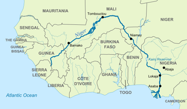
Map of River Niger by Hel-hama used under CC BY-SA 3.0
|
The Nile River
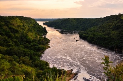
Evening, Nile River by Rod Waddington used under CC BY-SA 2.0
|
The largest of rivers in Africa, the Nile River runs over 4,000 miles, starting near the equator and flowing north all the way to the Mediterranean Sea. To see the Nile's path, click here. Like the Niger, the Nile has several other rivers that flow into it, including the Blue Nile, White Nile, and the Atbara. Historically speaking, most of the river was mapped and explored throughout the 1800s. For about 30 years, starting in 1821, parts of north and central Sudan were explored, and later, in 1850, lakes farther south were found. (Harold Edwin Hurst, 2016)
The source of the Nile was found in 1858 by a man named John Hanning Speke while on an expedition throughout east Africa. He later went on to name that source Lake Victoria. (Cavendish, 2008) |
The Sahara Desert
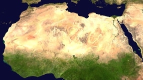
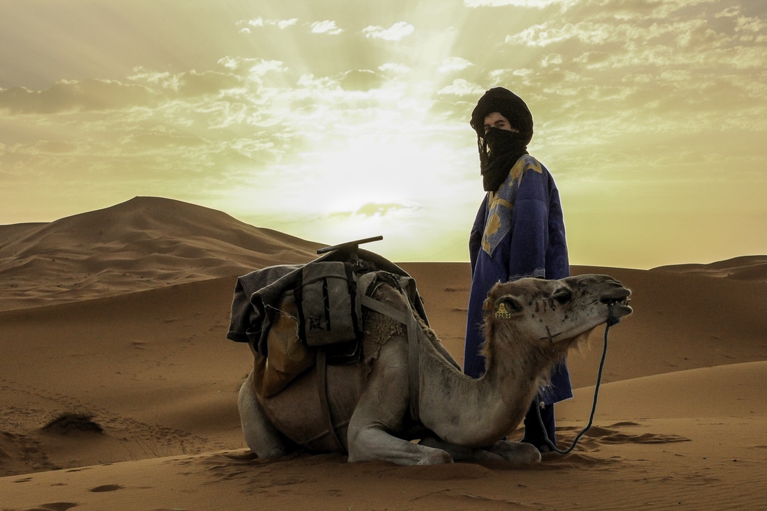
Being the largest desert in the world, the Sahara takes up over 3.3 million square miles, spreading all across northern Africa. That is roughly the size of the United States! Made up of two types climates, dry subtropical and dry tropical, the desert experiences different sorts of weather throughout the year. Additionally, rainfall does occur in each climate, but the average amount of precipitation is only 3 to 5 inches a year. Historically, in the 19th century, much of the desert was discovered while explorers were determining the path of the Niger River. In 1822, the desert was successfully crossed by Dixon Denham, Walter Oudney, and Hugh Clapperton. Throughout the years, many other explorers from France, Scotland, and Germany accomplished treks across the Sahara. Additionally, due to European militaries occupying the desert, much more exploration was completed before the turn of the 20th century. (Gritzner & Peel, 2015)
The Atlas Mountains
The Atlas Mountains are made up of four connecting ranges including the Middle Atlas, the Tell Atlas, the High Atlas, and the Saharan Atlas. Beginning in southwest Morocco, the range heads northeast through Algeria and ends in Tunisia, traveling roughly 1,200 miles. The highest point amongst the range, Mount Toubkal, stands at 13,665 feet in the High Atlas. (İsnard & Mikesell, 2012) In addition to Mount Toubkal, the city of Marrakech holds quite a bit of history. One structure being the Bahai Palace, which was built in the middle 1800s. The El Badi Palace, Koutoubia Tower & Mosque, and Saadian Tombs are also great places located in Marrakech that date back even farther to the 1500-1600s. (Terry & Terry, 2015) Lastly, an interesting and rather sad fact dating back to 1870 is that the Atlas Bear, the only bear native to Africa, became extinct after the last one was killed in north Morocco. (Ursus arctos crowtheri a.k.a. Atlas bear, Atlas brown bear, N/A)


Images from left to right: Bahia Palace by Lionel Leo used under CC BY-SA 3.0; Maroc Marrakech by Luc Viatour / www.Lucnix.be used under CC BY-SA 3.0; High Atlas by Nouari0 used under CC BY-SA 3.0
References:
- Cavendish, R. (2008, August). The Nile's Source Discovered. Retrieved from HistoryToday: http://www.historytoday.com/richard-cavendish/nile’s-source-discovered
- Gleick, P. H. (2000). The World's Water, 2000-2001: The Biennial Report on Freshwater. Island Press.
- Gritzner, J. A., & Peel, R. F. (2015, December 14). Sahara. Retrieved April 10, 2017, from Encyclopedia Britannica: https://www.britannica.com/place/Sahara-desert-Africa#toc516375main\
- Hurst,H. E.; M. M.-K. (2016, October 5). Nile River. Retrieved April 9, 2017, from Encyclopedia Britannica: https://www.britannica.com/place/Nile-River
- İsnard, H., & Mikesell, M. W. (2012, July 3). Atlas Mountains. Retrieved April 10, 2017, from Encyclopedia Britannica: https://www.britannica.com/place/Atlas-Mountains#toc36945
- Mabogunje, A. L. (2009, April 14). Niger River. Retrieved April 8, 2017, from Encyclopedia Britannica : https://www.britannica.com/place/Niger-River#toc37072
- Terry, P., & Terry, S. (2015, November 4). MARRAKECH (OR MARRAKESH) – THE HUB OF MOROCCO. Retrieved April 10, 2017 , from The Independent Tourist: https://theindependenttourist.net/2015/11/04/marrakech-or-marrakesh-the-hub-of-morocco/
- Ursus arctos crowtheri a.k.a. Atlas bear, Atlas brown bear. (N/A, N/A N/A). Retrieved from www.prehistoricwildlife.com: http://www.prehistoric-wildlife.com/species/u/ursus-arctos-crowtheri-atlas-bear.html
